


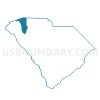
Pineview Voting District, Greenville County, South Carolina
About
Outline

Summary
| Unique Area Identifier | 665795 |
| Name | Pineview Voting District |
| County | Greenville County |
| State | South Carolina |
| Area (square miles) | 8.06 |
| Land Area (square miles) | 8.03 |
| Water Area (square miles) | 0.03 |
| % of Land Area | 99.68 |
| % of Water Area | 0.32 |
| Latitude of the Internal Point | 34.64719440 |
| Longtitude of the Internal Point | -82.23478440 |
Maps


Graphs
Select a template below for downloading or customizing gragh for Pineview Voting District, Greenville County, South Carolina


Neighbors
Neighoring Voting District (by Name) Neighboring Voting District on the Map
- Fork Shoals Voting District, Greenville County, SC
- Fountain Inn 2 Voting District, Greenville County, SC
- Greenpond Voting District, Laurens County, SC
- Hickory Tavern Voting District, Laurens County, SC
- Long Creek 1 Voting District, Greenville County, SC
- Raintree Voting District, Greenville County, SC
Top 10 Neighboring County Subdivision (by Population) Neighboring County Subdivision on the Map
Top 10 Neighboring Place (by Population) Neighboring Place on the Map
Top 10 Neighboring Unified School District (by Population) Neighboring Unified School District on the Map
Top 10 Neighboring State Legislative District Lower Chamber (by Population) Neighboring State Legislative District Lower Chamber on the Map
- State House District 28, SC (45,037)
- State House District 27, SC (41,268)
- State House District 14, SC (33,392)
- State House District 16, SC (32,736)
Top 10 Neighboring State Legislative District Upper Chamber (by Population) Neighboring State Legislative District Upper Chamber on the Map
Top 10 Neighboring 111th Congressional District (by Population) Neighboring 111th Congressional District on the Map
Top 10 Neighboring Census Tract (by Population) Neighboring Census Tract on the Map
- Census Tract 9201.04, Laurens County, SC (3,311)
- Census Tract 31.03, Greenville County, SC (2,773)
- Census Tract 31.04, Greenville County, SC (2,000)